Tag Archives: Friends of the Gualala River

Despite all the valid reasons to deny the Dogwood timber harvest plan, the logging in the floodplain of the Gualala River, CAL-FIRE has just approved it. The logging plan starts at the boundary of Gualala Point Regional Park Campground and then goes up river for more than five miles. The solid red in the photo below shows Dogwood. The red with yellow is "Apple," a recently approved THP.
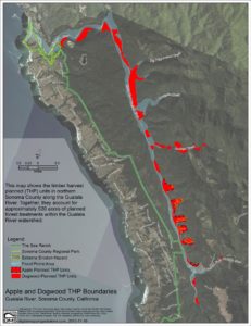
Apple and Dogwood THP Boundaries - Handout (Large)There will be a Community Protest Rally at Gualala Point Regional Park on Saturday July 16, from 11 am to noon. Sonoma County Parks has waived the entrance fee for this event. Enter the park on the west side of Highway One. Just after the pay station, is a parking area called the Salal parking area. We will congregate there, beginning at 10:30 am.
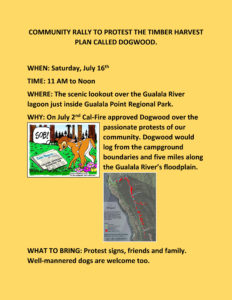
COMMUNITY RALLY TO PROTEST THE TIMBER HARVEST PLAN CALLED DOGWOOD - yellow!At 11 we will walk down the path in the meadow, which passes by the Serge, totems, and then to the parking area which overlooks the Gualala River Lagoon.

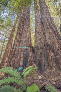
Mike Shoys recently photographed some of Dogwood. You will see mature Redwood trees marked in blue for logging.
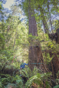
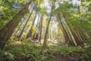
Dogwood3 by Mike Shoy Dogwood2 by Mike Shoy Dogwood4 by Mike ShoyThe new owners of this land, some 29,000 acres, should not be allowed to log in the floodplain of the river. These 400+ acres are a part of the Gualala River's ecosystem.This area was logged nearly a hundred years ago. It shouldn't have been logged then and it shouldn't be logged now.

We urge the Burch family to sell these 400+ acres to Sonoma County Regional Parks where the land would be added to the existing park, giving our community, and those who visit our area, a river park to cherish.

Thanks to Mike for allowing me to share his photos with you here. To learn much more about Dogwood, here is the link to the Friends of the Gualala River's website: http://gualalariver.org/

You will read on FoGR's website that a "Notice of Intent to Sue" has been filed by FoGR and Forest Unlimited. They will need donations for this necessary legal action. Here is Forest Unlimited's website: http://forestunlimited.org/about-us/mission/

Hope to see some of you at the protest rally on Saturday!
2 Comments

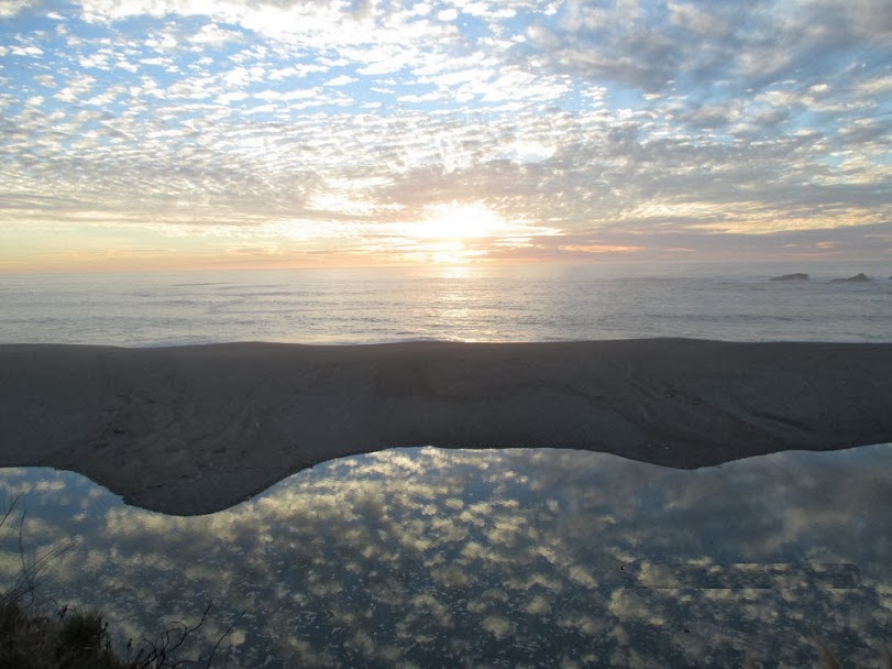
The clouds set the table for a beautiful scene and Joel Chaban was there with his camera.

Yes, the clouds are reflected in the Gualala River. You can see the huge sandbank just above the river. Since we have had very little rain, the Gualala is still closed to the Pacific Ocean. Bring on the rain, Mother Nature!

Thanks to Joel for allowing me to share his photo with you here. Joel is active in protecting this wild river. To learn much more about the Gualala River, you can visit the Friends of the Gualala River's website at: gualalariver.org.

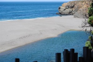
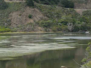
The Gualala River is as low as I've seen it. I recently took this photo showing the closed mouth of the river.

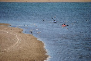
 Kayakers were spotted in the lagoon, where the water is deep enough to paddle.

There are many demands on this wild river. To learn about more about the Gualala River, here is the website for Friends of the Gualala River: http://gualalariver.org/river/default.html.

The Navarro River doesn't have the water demands that have caused the low levels in the Gualala. Here's a recent photo taken by Peter Baye of ruppia, an aquatic plant, in the full lagoon of the Navarro.

The ruppia is a good sign, a sign of a healthy river, according to Peter. I thank Peter for allowing me to share his photo with you here.

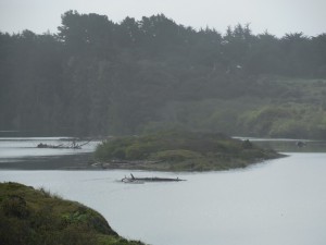
The Gualala River had been closed to the Pacific Ocean by a huge sandbar. We wondered if it was closed for the spring/summer or if it would open again. Then a storm brought over two inches of rain in the watershed and the river opened. This time Peter Baye was fortunate to witness the whole event, which occurred last Saturday, April 6.

The first two dramatic photos shows the before and after. Here the lagoon is full.

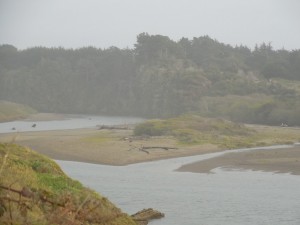
 And after the river opened, the river quickly drained down. It took about two hours.

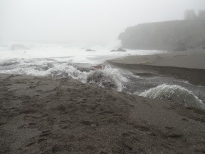
 Below is a photo of the beginning of the breach.

 And then the opening widened and the river was in full breach.

Here's what Peter had to say about his experience:

"I finally got a chance to view and photograph the Gualala lagoon breach cycle in full—from pre-breach to spill, initial cut, through full breach and stable inlet phases!  I stayed around in the morning long before it was close, to assess how fast it was creeping up – and decided it was worth a wait.

"Four hours later, after drawing a small crowd of breach-vigil onlookers, it got close to over-topping, when heavy fog patches came in waves around 2:30. I ran (literally) down to the beach and got fog-privatized “standing room only” photo perspectives and short videos as my camera batteries waned. They lasted until full breach. I returned to my car and got fresh batteries, and got one more set after the lagoon drawdown, and the tide began to rise and transform the outlet channel to a tidal inlet.

"It was an ecstatic and illuminating experience to watch the whole cycle. I’ve only caught them too early or too late (after breach), often without camera before."

Peter also took some video which will be posted on the Friends of the Gualala River website at this link:
http://gualalariver.org/

Many thanks to Peter for allowing me to share his photos with you here.

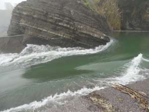
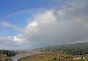
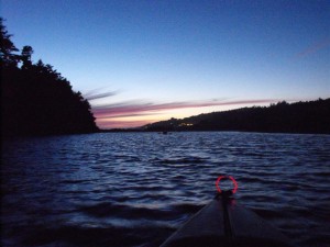
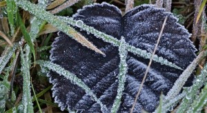
Last week Friends of the Gualala River and I hosted Gualala River Sightings at the Gualala Arts Center. People were invited to send in their favorite photos of our favorite wild river and its environs. Over 120 photos were sent in. I'm happy to be able to share the winning photographs with you.

Best above the river was taken by Peggy Berryhill:

Best in the river was taken by Rozann Grunig- kayaking under a full moon.

Best alongside the river (micro) was taken by Bryant Hichwa - icy morning leaves:

I will share more of the award winning photographs with you tomorrow. Many thanks to the talented photographers here